Die Route führt zu den panoramischsten Orten der Gegend um Tione di Trento, d.h. die Alm Malga Cengledino, die auf die Brenta-Gruppe und die Busa di Tione blickt, und den Monte Cengledino. Dank seiner zentralen Lage erlaubt der Monte Cengledino einen Überblick vom Val Rendena im Norden bis zu den Hochebenen von Bleggio und Lomaso im Osten und zum oberen Valle del Chiese im Süden.
Die einzigen Störfaktoren der ganzen Route sind die Antennen der Relaisstationen in der Nähe des Gipfelkreuzes. Doch mit ein wenig Umsicht kann man dennoch schöne Fotos des Kreuzes machen.
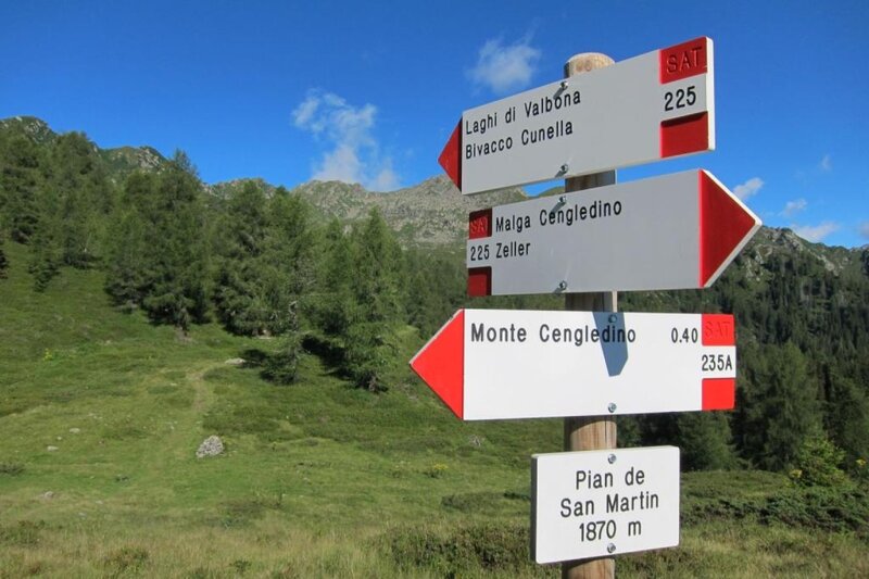
Vom Parkplatz in der Ortschaft Zeller aus folgt man dem Aufstieg zur Malga Cengledino, von der aus sich ein Blick auf die Brenta-Gruppe bietet. Der Weg führt durch einen dichten Nadelwald, umgeht teilweise die asphaltierte Straße und erreicht schließlich die Wiesen unterhalb der Alm. Über die Wiese gelangt man zur Alm und von dort aus zu einer Ebene, die im Sommer als Parkplatz genutzt wird und einen bequemeren Zugang ermöglicht. Von dort aus geht es weiter zur Piana di San Martino, einer grünen Mulde, in der im Frühling Rhododendren blühen. Der ansteigende Weg führt in einigen Serpentinen zum Gipfel des Cengledino. Von dort aus hat man einen Panoramablick auf die Berge, das Valle del Chiese, die umliegenden Dörfer und die Gipfel des Adamello, die das Val di Breguzzo überragen.
Es wird empfohlen, eine Kamera oder ein Handy mitzubringen, da die Ausblicke echte Postkartenmotive bieten. Im Sommer, wenn die Alm geöffnet ist, kann man die Strecke verkürzen, indem man mit dem Auto bis zum Parkplatz oberhalb der Malga Cengledino fährt – auch ohne Genehmigung der Gemeinde. Zu anderen Jahreszeiten ist es verboten, die asphaltierte Strecke von Zeller zur Alm mit dem Auto zu befahren.