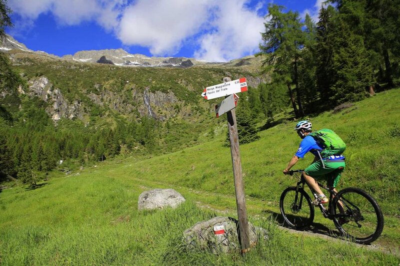
For lovers of mountain bikes, there are many forest roads and mountain trails offering a way to visit places that would otherwise remain inaccessible.
Mountain biking / e-biking
With your mountain bike, you can cycle along your choice of asphalt, dirt and forest roads, cycle paths and old country lanes in a continuous succession of different views and terrains, with the opportunity to appreciate the traditional hospitality of the mountain’s inhabitants in the malghe and baite (mountain cottages and huts), in the rifugi and masi (lodges and farmsteads). And don’t forget about the Dolomiti di Brenta Bike, a long tour which loops its way around the Brenta Dolomites and is sure to satisfy both casual bikers seeking to unwind and dedicated sportspeople.
The Dolomiti di Brenta Bike (DBB) is the top mountain bike tour in Trentino. Located close to Lake Garda, it crosses the western Dolomites to form an MTB alpencross route that loops around the Brenta Dolomites. Designed to be completed in stages and over several days, it was created with true MTB- and adventure-lovers in mind: 171 km long, with an overall altitude change of 7,700 m.
The DBB is split into two circuits:
Routes through the Central Giudicarie Valleys:
1. TIONE - Le Sole - Malga Cengledino - Zeller - TIONE
Description:
From Tione (565 m), a paved road leads to Le Sole (1,385 m). From here it’s level going until the turn-off (on the right) for Malga Le Sole (1,494 m). At the sharp turn with the barrier, turn right for Malga Cengledino (1,667 m), after which there is an easier descent to Zeller (1,378 m) and from there to Tione (565 m) along the paved road that passes by the Madonna del Monte.
Details:
- Length: 44 km
- Altitude change: 1,600 m
- Time required: 3-4 h
- Nature of the route: 100% by bike
- Difficulty level: difficult
- Alternative route: at the sharp turn with the barrier, turn left for Malga Lodranega (1,658 m). Outward journey and return along the same route.
2. TIONE - Coltura - Val d'Algone - Malga Movlina crossroads - Pertiche - Passo Durmont - Montagne - TIONE
Description:
From Tione (565 m), pass by Preore and Coltura (602 m) to get to the crossroads for Val d'Algone (Pont del Lisagn, 603 m) along a paved road, before climbing to Rifugio Ghedina (1,126 m). Continue as far as the crossroads at an altitude of 1,575 m (turn right for Malga Movlina). Descend towards Monte Plan and, at the first turn-off, go down along the dirt track to the left. At the end of the dirt track, go down and to the right along the trail with yellow stickers that leads to a forest road (steep) bringing you to Pertiche (1,327 m). The land appears to level out here, turning to the left as far as the crossroads with the road that climbs from Spiazzo towards Passo Durmont (1,300 m). A paved road takes you from here to Preore (580 m) and then back to Tione (565 m).
Details:
- Length: 38 km
- Altitude change: 1,100 m
- Time required: 3-4 h
- Nature of the route: 100% by bike
- Difficulty level: moderate
- Alternative routes:
1. Shortly after Passo Durmont, you have the option to descent towards Spiazzo.
2. From the turn-off at an altitude of 1,575 m, you can get to Malga Movlina or take a number of descents towards Giustino-Pinzolo
3. TIONE - Montagne - Pra de l'Asen - Passo Durmont - Pertiche - Bocenago - Caderzone - TIONE
Description:
From Tione (565 m), take the paved road as far as Preore (530 m) then a climb to the left towards Montagne (Cort, Larzana, Binio). Turn left here towards Passo Durmont (1,300 m). Descend as far as the first sharp bend on the left, where you will climb to the right along a paved road towards Stablo (1,215 m). Shortly after this, the paved road ends and a dirt road continues as far as Palastro (1,224 m) and Pertiche (1,327 m), where a descent — again along a dirt road — leads to Bocenago (750 m) and from there to Strembo and Caderzone. From Caderzone (723 m), a paved provincial road goes to Strembo, Bocenago (750 m) and Fisto. At Fisto, continue towards Ches with a descent along the left bank of the river Sarca along trails and dirt roads as far as Darè (600 m). Here, you can return to Tione (Sesena) via a paved street.
Details:
- Length: 36 km
- Altitude change: 800 m
- Time required: 3 h
- Nature of the route: 100% by bike
- Difficulty level: easy
- Alternative routes:
1. Direct descent from Passo Durmont to Spiazzo along a paved road.
2. The return journey to Tione can also be made quicker by taking the main road.
4. TIONE - Val d'Algone - Bregn de L'ors - Val d'Agola - S. Antonio - Pinzolo - TIONE
Description:
From Tione, go via Preore, Ragoli and Coltura (501 m) to Pont del Lisagn (620 m), where you will enter Val d'Algone. A mixed road (dirt and asphalt) leads to Rifugio Ghedina (1,126 m); after this, it is a dirt road that continues to Malga Movlina (1,803 m). A trail leads from here to Passo Bregn de l'Ors (1,836 m), after which another trail heads down as far as Lake Valagola (1,550 m) and then a dirt road to S. Antonio di Mavignola (1,123 m), passing by the Val Brenta forest nursery. From S. Antonio di Mavignola, turn left for the old road to Pinzolo. From Pinzolo (770 m), take the cycle path (allowing you to avoid the main road as much as possible) through Caderzone, Strembo, Bocenago, Fisto and Ches to get to Tione (Sesena).
Details:
- Length: 60 km
- Altitude change: 1,350 m
- Time required: 5-6 h
- Nature of the route: 90% by bike
- Difficulty level: easy
- Alternative routes:
1. Before Malga Movlina, a sharp bend at an altitude of 1,575 m allows a descent towards Massimeno, Bocenago, Giustino and Pinzolo.
2. From Passo Bregn de l'Ors, a descent on the left leads directly to Pinzolo.br />N.B. You must dismount and walk your bike for the stretch between Malga Movlina and Lake Valagola, as a natural protection measure.
5. TIONE - Pinzolo - Carisolo - Cascate Nardis - Pinzolo - TIONE
Description:
Follow the left bank of the river Sarca from Tione towards Ches, Fisto, Bocenago (750 m), Strembo (714 m) and Caderzone (723 m). From Caderzone, take the cycle path (avoiding the main road) to Carisolo (808 m). At the end of the settlement of Carisolo, turn left and take the road for Val Genova. The road climbs gently upwards as far as the Cascate Nardis falls. Return via the same route.
Details:
- Length: 46 km
- Altitude change: 470 m
- Time required: 2-3 h
- Nature of the route: 100% by bike
- Difficulty level: easy
- Alternative route: the return journey to Tione can also be made quicker by taking the main road.
6. BREGUZZO - Rifugio Pont'Arnò - Rifugio Trivena - TIONE
Description:
This itinerary allows visitors to see Valle di Breguzzo in its entirety. North of the village of Breguzzo (798 m), there is a large car park behind the church where you can leave your car. From the car park, take the main road towards Brescia until you get to the centre of the village. Here, to the right, you will find the turn-off for Valle di Breguzzo. Follow it and continue along the paved road as far as Rifugio Pont'Arnò. After this, cross the bridge over the river Arnò and turn left for alternative route 1) or keep going straight ahead to get to Rifugio Trivena. Cross over the next bridge along the river Arnò, turn left and take the dirt and cobbled road to begin the challenging climb towards Rifugio Trivena (1,633 m). Descent: Return via the same route.
Details:
- Length: 21 km
- Altitude change: 832 m (maximum altitude reached: 1,630 m)
- Time required: 2.5-3 h
- Nature of the route: 90% by bike
- Difficulty level: challenging climb in the last stretch - moderate descent
- Alternative route: Rifugio Pont'Arnò (1,103 m) - Malga d'Arnò (1,556 m): From the turn-off mentioned in the description of the main itinerary, the route continues along a paved road as far as the beautiful meadows of Malga d'Arnò (1,556 m). Return via the same route.
7. BREGUZZO - Malga Le Sole - Malga Cengledino - BREGUZZO
Description:
This itinerary offers a chance to get to know the mountains and meadows that stretch out above Tione. North of the village of Breguzzo (798 m), there is a large car park behind the church where you can leave your car. From the car park, take the main road towards Brescia until you get to the centre of the village. Here, to the right, you will find the turn-off for Valle di Breguzzo. Follow this as far as Rifugio Limes (929 m), then turn right for Le Sole (1,382 m). At the end of the climb, where the Sole plateau begins, take the turn-off to the left to get to the sharp turn with the barrier (alternative route 1). Keep right for Malga Le Sole (1,490 m) and Malga Cengledino (1,665 m), where the road begins to descend towards Zeller (1,378 m). Continue downwards to get to the crossroads for Le Sole, then turn right to climb back up to Le Sole and from there return to Breguzzo (798 m). Descent: From Le Sole, along the same route as the climb.
Details:
- Length: 26 km
- Altitude change: 1,033 m (maximum altitude reached: 1,831 m)
- Time required: 3-3.5 h
- Nature of the route: 100% by bike
- Difficulty level: easy
- Alternative route: Malga Le Sole turn-off (approx. 1,490 m) to Malga Lodranega (1,658 m). From the sharp turn with the barrier, turn left for Malga Lodranega (1,658 m).
MTB/E-bike itineraries for autumn
For bike-lovers, cycling through the fall foliage is a truly special experience.
BREGUZZO - Rifugio Pont'Arnò - Rifugio Trivena - TIONE
Description:
This itinerary allows visitors to see Valle di Breguzzo in its entirety. North of the village of Breguzzo (798 m), there is a large car park behind the church where you can leave your car. From the car park, take the main road towards Brescia until you get to the centre of the village. Here, to the right, you will find the turn-off for Valle di Breguzzo. Follow it and continue along the paved road as far as Rifugio Pont'Arnò. After this, cross the bridge over the river Arnò and turn left for alternative route 1) or keep going straight ahead to get to Rifugio Trivena. Cross over the next bridge along the river Arnò, turn left and take the dirt and cobbled road to begin the challenging climb towards Rifugio Trivena (1,633 m). Descent: Return via the same route.
Details:
- Length: 21 km
- Altitude change: 832 m (maximum altitude reached: 1,630 m)
- Time required: 2.5-3 h
- Nature of the route: 90% by bike
- Difficulty level: challenging climb in the last stretch - moderate descent
- Alternative route: Rifugio Pont'Arnò (1,103 m) - Malga d'Arnò (1,556 m): From the turn-off mentioned in the description of the main itinerary, the route continues along a paved road as far as the beautiful meadows of Malga d'Arnò (1,556 m). Return via the same route.
BREGUZZO - Malga Le Sole - Malga Cengledino - BREGUZZO
Description:
This itinerary offers a chance to get to know the mountains and meadows that stretch out above Tione. North of the village of Breguzzo (798 m), there is a large car park behind the church where you can leave your car. From the car park, take the main road towards Brescia until you get to the centre of the village. Here, to the right, you will find the turn-off for Valle di Breguzzo. Follow this as far as Rifugio Limes (929 m), then turn right for Le Sole (1,382 m). At the end of the climb, where the Sole plateau begins, take the turn-off to the left to get to the sharp turn with the barrier (alternative route 1). Keep right for Malga Le Sole (1,490 m) and Malga Cengledino (1,665 m), where the road begins to descend towards Zeller (1,378 m). Continue downwards to get to the crossroads for Le Sole, then turn right to climb back up to Le Sole and from there return to Breguzzo (798 m). Descent: From Le Sole, along the same route as the climb.
Details:
- Length: 26 km
- Altitude change: 1,033 m (maximum altitude reached: 1,831 m)
- Time required: 3-3.5 h
- Nature of the route: 100% by bike
- Difficulty level: easy
- Alternative route: Malga Le Sole turn-off (approx. 1,490 m) to Malga Lodranega (1,658 m). From the sharp turn with the barrier, turn left for Malga Lodranega (1,658 m).

