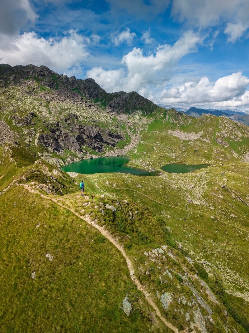
Panoramic ascent to the Valbona Lakes, offering spectacular views over Val Rendena, the Brenta Group, Carè Alto, and the Ledro Alps, all immersed in an environment rich in coniferous forests and rhododendrons.
The route starts from the locality Zeller, where the SAT trail 225 passes through, to be followed up to Malga Cengledino, here it climbs the pastures above and leads to the Valbona Lakes. As you gain altitude, the panorama of Val Rendena and the Brenta Dolomites becomes wider and more stunning. Through gentle ups and downs, you reach the Piana di San Martino, a green basin covered with larches and rhododendrons, located at the foot of Monte Cengledino (or Camp Antìc). Continuing, you encounter a small but characteristic wooden hut, used as a shelter, called “Bait dei Caciador” or “Bait Fontana dele Laste”. Finally, the route continues along the hillside to the longed-for lakes, within the Adamello Brenta Natural Park-Geopark, where a rocky amphitheater frames the waters of an intense azure.
Continue your walk on The Path of the Valleys, choose other valleys to explore among the 50 proposals! Discover them all and create the credential to record your passes here: www.campigliodolomiti.it/laviadellevalli.
Attention: The valley currently does not have the final stamp.
Missing the sign with the stamp? Report it to us! (laviadellevalli@campigliodolomiti.it).
NEARBY VALLEYS:
From Valbona it is possible to connect with:
- Upper Valley: continuing beyond the lakes along the SAT 225 trail;
- San Valentino Valley: continuing beyond the lakes along the SAT 225 trail then turning at the junction onto SAT 261 trail;
- Trivena Valley: continuing beyond the lakes along the SAT 225 trail then turning at the junction onto SAT 260 trail “Senter de Laghisòl”;
- Breguzzo Valley: continuing beyond the lakes along the SAT 225 trail then following a stretch of SAT 260, upon reaching Malga Laghisol switch to SAT 264 trail “Senter de Cóal” and at Malga Cóel take SAT 264a trail “Senter de Cóal basso”.